
Who is involved
In recent days, residents of New Jersey and the surrounding Baltimore region have been on high alert as weather forecasts indicated a potential for severe storms. Prior to the issuance of the tornado watch, expectations were relatively calm, with no immediate threats anticipated. However, as meteorological conditions evolved, the National Weather Service issued a tornado watch for most of New Jersey, including the entire Jersey Shore region, effective until 7 p.m. on March 16, 2026.
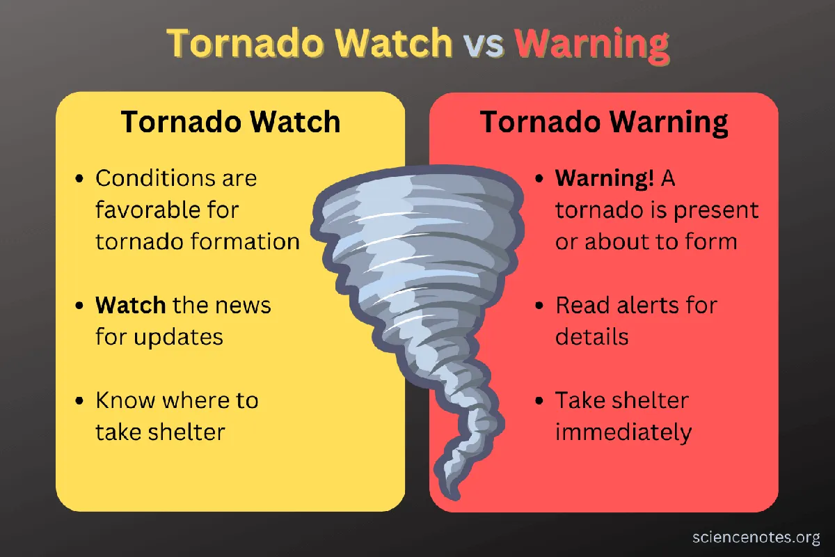
The decisive moment came as meteorologists observed conditions that could lead to tornado development. The tornado watch signifies that conditions are favorable for tornadoes, contrasting with a tornado warning, which indicates that a tornado has been sighted or indicated by radar. As the watch was issued, the risk of tornadoes in Baltimore was assessed at 10%, suggesting a notable but not overwhelming threat within a 25-mile radius.
In response to the evolving weather situation, Governor Wes Moore declared a State of Preparedness for severe weather in Maryland. This declaration is a proactive measure aimed at coordinating readiness efforts across state government in anticipation of the incoming storms. Schools in Baltimore City and Baltimore County took precautionary steps, closing two and three hours early, respectively, to ensure the safety of students and staff.
As the day progressed, the severe weather threat began to taper off for the Baltimore area, with meteorologist Ava Marie noting, “The severe threat is almost over for the Baltimore area.” This statement provided some reassurance to residents, although the tornado watch remained in effect for York, Lancaster, Lebanon, and Dauphin County for a few more hours. The cancellation of the tornado watch for the Susquehanna Valley indicated a shift in the immediate threat level, although damaging winds and tornadoes were still possible in some areas of the Baltimore metro.
Power outages became a concern as strong winds were forecasted during the storm, with wind advisories in effect for gusts up to 50 mph east of the Susquehanna River. The potential for such winds, combined with the ongoing tornado watch, heightened anxiety among residents who were reminded of the rarity of such conditions in Maryland. It is uncommon for the state to have a tornado risk greater than 5%, making this situation particularly noteworthy.
As temperatures are expected to drop into the 20s by Tuesday morning following the storm, the community is left to grapple with the aftermath of the severe weather. The last tornado watch issued in the area was 365 days ago, underscoring the unusual nature of the current weather patterns. Residents are urged to remain vigilant and prepared as the situation continues to evolve.
In summary, while the immediate threat of severe weather is diminishing for some areas, the issuance of a tornado watch has prompted significant responses from local authorities and communities alike. As the storm passes, the focus will shift to recovery and ensuring that residents are safe and informed about any lingering risks. Details remain unconfirmed regarding the full impact of the storm, but the proactive measures taken by officials reflect the seriousness of the situation.