
Tornado Watch in Effect
A tornado watch is currently in effect for the Kansas City metro area until midnight, as severe weather conditions develop across the region. Additionally, a tornado watch has been issued for all of Michiana until 2 a.m. Wednesday, with residents advised to remain vigilant.
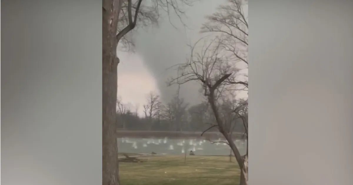
In Illinois and Indiana, a tornado watch is active for Ford, Grundy, Kankakee, LaSalle, Livingston, and Iroquois counties until 11 p.m. Reports indicate that confirmed tornadoes have already been observed in parts of northwest Indiana, raising concerns among local authorities.
As part of the severe weather alerts, a tornado warning is currently in effect for La Porte County, Indiana, until 9 p.m. This warning comes alongside a severe thunderstorm warning for several counties in Illinois and Indiana, which is also set to last until midnight.
Residents in Kankakee, Illinois, have reported large hail measuring as much as 5.2 inches, adding to the hazardous conditions. The entire Chicago area is under a high risk for flooding and tornadoes through 1 a.m. Wednesday, prompting officials to urge preparedness.
According to CBS News Chicago Chief Meteorologist Albert Ramon, “It is vital that you have multiple ways to receive warnings and be ready to act quickly if a warning is issued.” This advice is particularly important as storms are developing rapidly, bringing the threat of tornadoes and large hail.
The National Weather Service has highlighted that the main threat with the strongest storms will be damaging wind gusts, which could reach up to 70 miles per hour, along with locally heavy rainfall that may lead to flash flooding.
As the situation evolves, observers are closely monitoring the weather patterns to provide timely updates. Details remain unconfirmed regarding the full extent of the impact across the affected regions.