
Impact of Recent Weather Conditions
The tornado watch for central and east-central Georgia has expired, but the effects of severe weather continue to pose risks across the region. A wind advisory is currently in effect for North and Central Georgia until 8 p.m. Thursday, with north to northwest wind gusts expected to reach up to 35 mph.
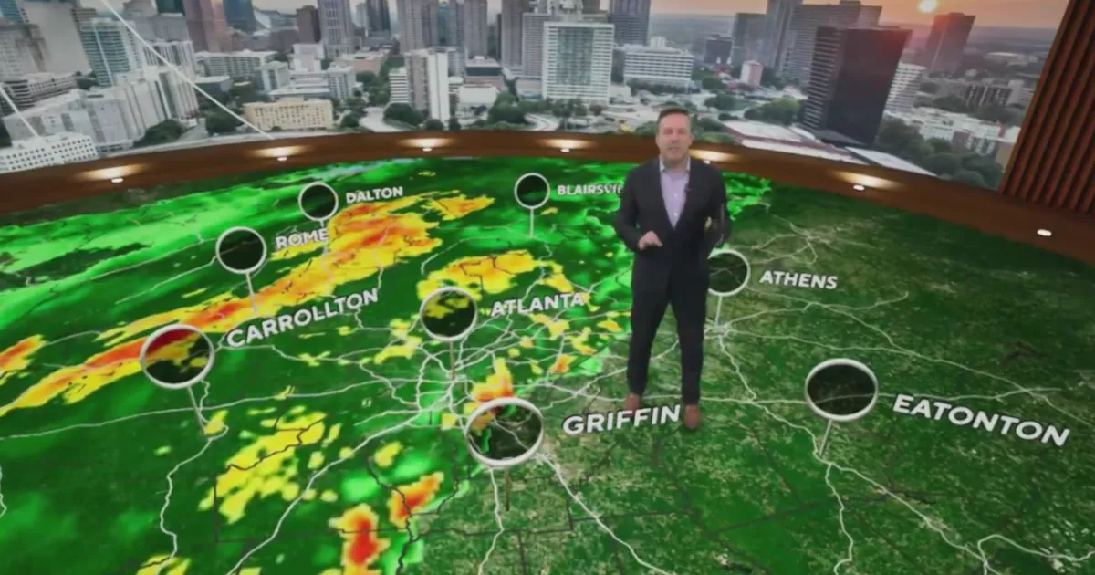
Earlier storms brought heavy rain, saturating the ground and increasing the risk of downed trees and power outages. Wind gusts during these storms approached 60 mph, leading to significant concerns about safety and infrastructure.
School Delays and Safety Measures
In response to the severe weather threat, several school systems have delayed the start of classes. The Meriwether County School System, Troup County School System, and Rockdale County Public Schools announced a two-hour delay for school openings to ensure the safety of students and staff.
Light rain is expected to continue for several hours in areas east of Interstate 75, further complicating conditions as residents deal with the aftermath of the storms.
Future Weather Outlook
Looking ahead, another weather system is anticipated to bring thunderstorms to the region from Sunday into Monday. Residents are advised to stay alert and monitor updates as conditions may change rapidly.
The National Weather Service reported that strong storms swept across Georgia early Thursday, highlighting the need for preparedness in the face of unpredictable weather patterns.
Details remain unconfirmed regarding the full extent of damage caused by the recent storms, but the community is urged to remain vigilant as further developments unfold.