
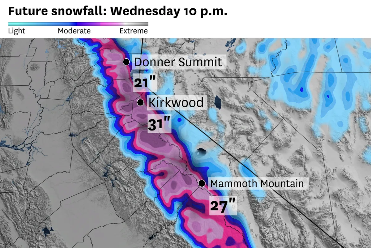
The Sierra Nevada is facing a severe winter storm that could dramatically affect travel and outdoor activities. With winter storm warnings and advisories in effect, the region is expected to receive more than two feet of snow in certain areas, particularly at high elevations.
Travel impacts are forecasted for Tuesday due to snowfall rates of 1 to 2 inches per hour. This means that major routes, including Interstate 80 and Highway 50 mountain passes, could see over a foot of snow. High-elevation ski resorts may even receive up to three feet of snow, making it a double-edged sword for winter sports enthusiasts.
Warnings extend from Lassen National Park all the way to Yosemite, Sequoia, and Kings Canyon national parks. The heaviest snow is anticipated Tuesday afternoon and evening above 5,000 feet in the northern Sierra and above 7,000 feet in the southern Sierra. Travel could become treacherous as gusts reach up to 50 mph at mountain passes and even 90 mph atop ridges.
But why is this storm so potent? According to meteorologist Chris Smallcomb, “The moisture trajectory is out of the south with this storm, and that is typically not good for spillover precipitation east of the Sierra crest.” This indicates that the storm system has gathered substantial moisture before hitting the mountains.
This marks the second winter storm warning this month for the west slope of the Sierra—a notable occurrence since it’s the most warnings issued in a single April since 2010 by the weather service office in Sacramento. Such frequency highlights a concerning trend in extreme weather patterns.
As we look ahead, it’s crucial to remain vigilant. While current forecasts indicate significant snowfall and potential travel disruptions, details remain unconfirmed regarding specific impacts on local infrastructure and emergency services.