
What to Expect from the Upcoming Snowfall
The central question surrounding the upcoming snowfall weather forecast is: how much snow can residents of Denver expect? The answer is significant, with total snow accumulations for the northern and southern Front Range foothills, as well as areas like Castle Rock, Elizabeth, and Larkspur, projected to be anywhere between 3 inches and a foot of snow.
A winter weather advisory will go into effect for the next 24 hours starting at midnight Thursday, covering the High Mountain Parks, the Front Range Foothills, the Park Range mountains, and the Palmer Divide. Additionally, a winter storm warning will be in effect from midnight Thursday through midnight Friday for the Front Range mountains, the Medicine Bow Range, the mountains of Summit County, and the Mosquito Range. Localized snowfall rates of 1-2 inches per hour can be expected under the heaviest snow bands.
Current Conditions and Historical Context
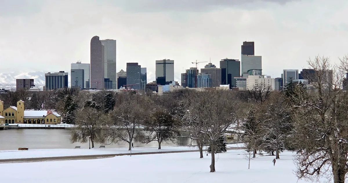
As of now, the City of Denver is preparing for a challenging weather event. The last measurable snowfall in the Mile High City occurred on January 25, marking a significant gap in winter weather. Forecasts indicate that Denver could see between a trace to 2 inches of snow, while the Front Range mountains may receive up to 6 inches. Areas further into the mountains, such as East Portal, could see as much as 15 inches of snow.
Stacey Donaldson, a meteorologist, noted, “Overall, it looks like light amounts of snowfall … should be pretty slushy here for our area; it’s just been so warm lately.” This statement reflects the recent warmer temperatures that have characterized the region, contrasting sharply with the impending winter storm.
Travel Implications and Safety Measures
Travelers heading to the mountains or foothills should prepare for a tough morning commute on Friday, as slick conditions are expected. Commuters should prepare for slick conditions in the morning regardless of their destination. The National Weather Service in Boulder has also issued a red flag warning until 6 p.m. Thursday, indicating critical fire danger conditions that can quickly shift to heavy snowfall.
In response to the cold weather, the City of Denver has activated its cold weather shelter plan. All shelter sites are pet-friendly and provide essential services, including food, showers, and blankets, to those in need. This proactive measure aims to ensure the safety and well-being of vulnerable populations during the severe weather.
Looking Ahead
As the storm progresses, highs on Friday for the I-25 corridor will be in the mid to upper 30s, with milder and drier weather expected to return on Saturday, bringing a high of 50 degrees. However, the immediate focus remains on the snowfall and its impact on the community. It wouldn’t be Colorado if we didn’t have critical fire danger conditions followed by heavy snow just a day later, highlighting the unpredictable nature of the state’s weather.
Details remain unconfirmed regarding the exact impacts of the snowfall, but residents are advised to stay updated with local forecasts and prepare for potential disruptions. The coming days will reveal how this winter storm unfolds and its effects on the Denver area.