
Severe Weather Alerts for Indianapolis
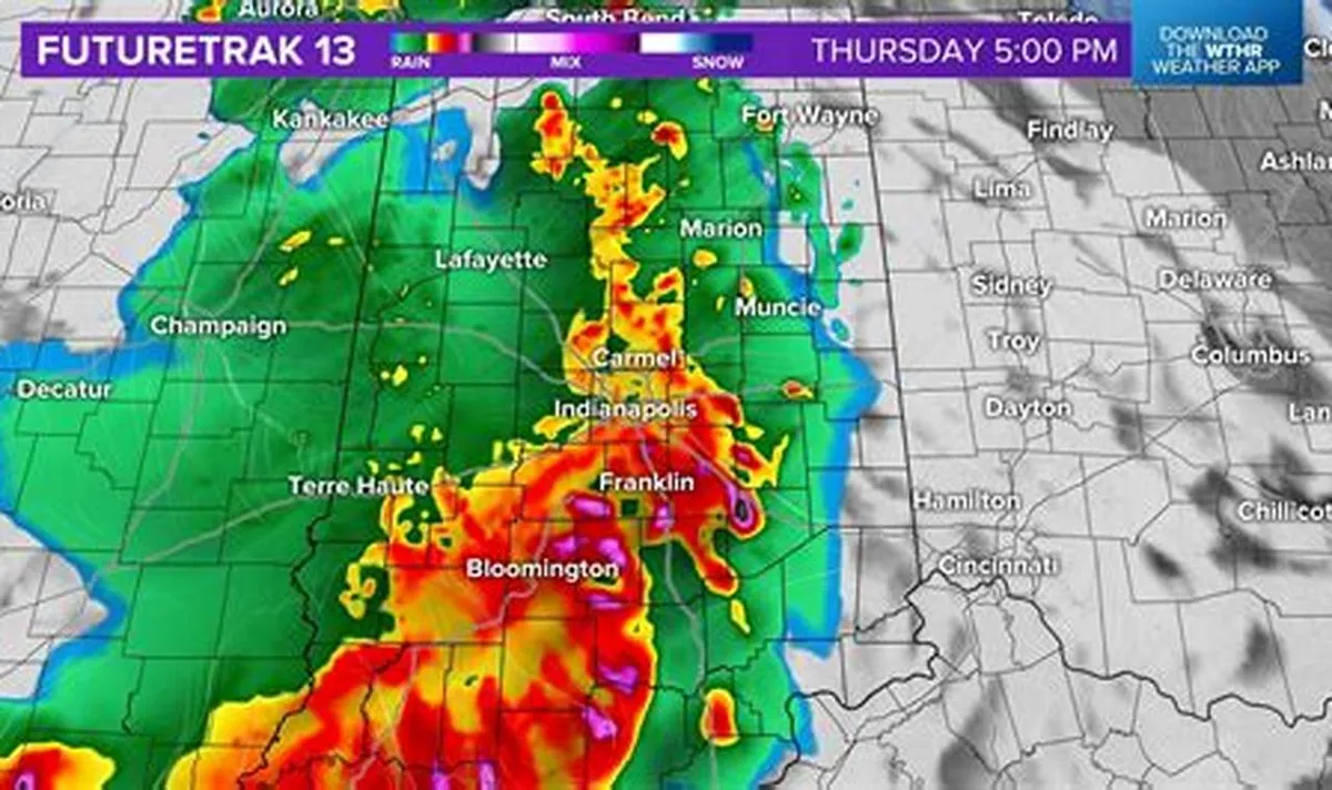
A tornado watch has been issued for most of Indianapolis and surrounding areas until noon on March 11, 2026. Residents are urged to stay vigilant as severe storms and damaging winds are expected to impact central Indiana throughout the day.
According to the National Weather Service, thunderstorms will be capable of producing damaging straight-line winds, large hail, very heavy rain, and isolated tornadoes. The high temperature for the day is forecasted to reach 69 degrees Fahrenheit, while the low will drop to around 31 degrees overnight.
Heavy Rainfall and Flooding Risks
Heavy rainfall is anticipated, with projections indicating that up to 2 inches could accumulate during the day. Flooding is a significant concern, especially in low-lying areas. Marion County residents can sign up for emergency alerts by texting MESAINDY to 67283 to stay informed about any developments.
Wind gusts could reach between 45 to 50 mph outside of storms, adding to the hazardous conditions expected on March 11. The severe weather comes during Severe Weather Preparedness Week in Indiana, which runs from March 8 to March 14, 2026.
Historical Context of Severe Weather in Indiana
Indiana has a history of severe weather, with 62 tornadoes recorded in the state in 2025, marking the second-highest number since 1950. This historical context highlights the importance of preparedness as residents face the potential for severe weather events.
As the cold front moves through, temperatures are expected to drop significantly, leading to a stark contrast in weather conditions. Observers are closely monitoring the situation, and details remain unconfirmed as the day progresses.