
Who is involved
In recent days, Central North Carolina had been experiencing relatively calm weather, with no immediate threats on the horizon. However, as meteorologists began to analyze incoming weather patterns, expectations shifted dramatically. The National Weather Service issued a Level 4 of 5 severe storm risk for the region, indicating a significant increase in the potential for severe weather.
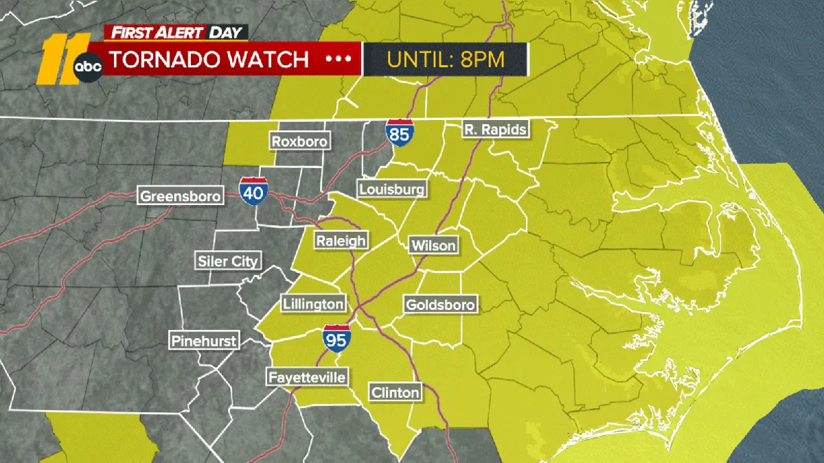
The decisive moment came when a Tornado Watch was issued for parts of central North Carolina, including the Triangle area. This watch is in effect until 8 p.m. today, and it highlights the possibility of damaging wind gusts and even long-track tornadoes. Wind gusts are expected to reach around 40 mph throughout the day, with some areas potentially experiencing gusts as high as 55 to 75 mph.
The immediate effects of this warning have been felt across the region. Several school districts have closed their doors for the day in response to the storm threats, prioritizing the safety of students and staff. Additionally, a tornado warning has been specifically issued for northern Moore County until 11 a.m., prompting residents to take shelter and prepare for potential severe weather.
Experts have weighed in on the situation, emphasizing the seriousness of the current storm risks. WRAL meteorologist Aimee Wilmoth advised, “If you hear thunder you need to be inside,” underscoring the urgency of taking precautions during such severe weather events. Furthermore, WRAL meteorologist Elizabeth Gardner noted, “For the first time in five years, our area is under a Level 4 risk out of 5,” highlighting the rarity and severity of this situation.
This heightened level of risk is particularly concerning given that the last time Central North Carolina faced a Level 4 risk was in March of 2021. The region is now bracing for the potential impacts of this severe weather, with wind damage being the largest threat today.
As the day progresses, the severe storm risk is expected to diminish around sunset, with lingering showers tapering off before midnight. However, the immediate focus remains on the safety of residents as they navigate the potential dangers posed by high winds and tornado threats.
In summary, the tornado warning in Central North Carolina marks a significant shift in weather expectations, with experts urging caution and preparedness among residents. As the situation develops, officials and meteorologists will continue to monitor conditions and provide updates to ensure public safety.